Tourism
Broad acre dry land farming is the backbone of the Central Wheatbelt. Around 40% of the States grain harvest comes from the region. The region holds many heritage sites and museums that illustrate the evolution of the grain industry, the machinery used and the dedication of generations of farmers and railway people in establishing the efficient industry there is today.
Trayning has natural granite outcrops, native birds, insects, reptiles, woodlands and stunning panoramas of wildflowers in season which are all easily accessible here. Just 70 kilometres from Merredin in the heart of the North Eastern Wheatbelt, with good roads, the Shire attractions are well sign posted with maps readily available.
The name ‘Trayning’ was given to the district after the ‘Trayning Well’ and the name for the well was derived from two aboriginal names ‘Durri-iring’ or ‘Duranning’. The words mean ‘to crawl’, and ‘a camping place’ and over time became known as ’snake crawling in the grass near campsite’.
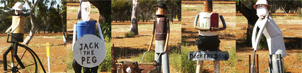
Today the district produces mostly wheat and sheep and there are many remnants of the past scattered throughout the Shire. With its natural beauty and pioneer heritage Trayning is a MUST SEE Shire.
Kununoppin, Trayning and Yelbeni are a part of this wonderful self drive tour of the Wheatbelt, for further details and to download trail maps, please (Click here)
Shire of Trayning District Map
Trayning Town Site Map
Kununoppin Town Site Map
Yelbeni Town Site Map