History of the Shire
John Septimus Roe’s survey party travelled through the Mangowine area in October, 1836. From 1845, sandalwood cutters gradually opened up tracks into the hinterland so people could have passed through these areas after the 1850’s. Further exploration of the region was undertaken in June 1860 by members of the Dempster family seeking pastoral country but water was scarce. Again in July 1861 they travelled as far as the Yilgarn. A few years later they grazed a mob of sheep in the Kodji Kodjin area but lack of water and poison plants forced them out.
Later, Surveyor Charles Hunt in 1865 opened up tracks and established wells and dams in areas to the south and east of this Shire.
In 1867 Henry Twine and Charles Adams explored the land east of Toodyay towards Lake Brown and Twine took up leases totalling 6,070 ha (15,000 acres). In 1868 these leases were transferred to Charles Adams and James Ward. The leases were around Yarragin and eastward to Barbalin and extending N.W. from Yarragin for a mile or so. Another lease took in land S.E. of Billyacatting. Adams and Ward also had a tillage lease at Yarragin.
The first home was built at Yarragin and Charles Adams with wife Jane, were accompanied by Jane’s sister and brother in law, James and Janet Ward and Alex Glass, a brother to Jane and Janet. Many of the earliest settlers were connected by marriage.
Henry Twine’s sheep flock was grazed on a wool rental basis by Charles Adams.
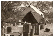
 The nearest outpost to Yarragin was Goomalling and nearest town for trading, Toodyay. Twice yearly the journey by dray was made to take out wool and sandalwood and to obtain supplies. These people had to use local materials and their own skills to build homes and provide for most of their own food requirements and other needs. Life was never easy, especially for the women who had to bake their own bread, make butter, preserve meat and make candles and clothes. They soon established gardens with fruit trees and vegetables.
In 1870 low wool prices almost caused Charles Adams to abandon the area, he sold his interests to James Ward but an upturn in wool prices in 1871-73 saw him take up leases at Mangowine and the family settled there in 1874.
Charles Glass, father of Alex, Jane and Janet, left his son Charles on the farm and Wongamine and moved to Walcancobbing S.E. of Kununoppin but soon shifted from there to Quelkan. Stone chimneys, one of which still stands in the S.W. corner of Billyacatting Reserve, mark the sites of these early camps. Charles with son Alex settled at Moujakine and built a homestead there. Availability of water or lack of it was the reason for the early moves.
 During the 1870s further people settled in the area toward the east and south. Charles Adams in 1879, was authorised by the Toodyay Road Board to sink wells along the Toodyay-Yarragin Road including the one at Trayning.
In 1887 Alex Glass and his mother discovered a small nugget of gold while cleaning out a well. One account of this event tells of a drowned possum being the reason for cleaning the well. This gold discovery led to a number of searches further inland and in 1888 the Yilgarn Goldfield was proclaimed.
From this time on a stream of hopefuls were heading to the goldfields. The Yarragin track with its line of wells was one of the principal early routes to Golden Valley and the Yilgarn. That find at Moujakine led to the development of the eastern goldfields. Moujakine, Yarragin and Mangowine all became important stopping places for weary travellers and brought the chance for settlers to trade with them. Wayside Inn licenses were held at Yarragin and Moujakine in 1888. The heap of mud that marks the site of the old Yarragin homestead was also the home of our first “watering hole”. The Wayside Inn licenses would have been fairly short lived for once the railway to Southern Cross was opened the passing trade would have dropped to nothing. Arnold Butterly had been the lessee of Yarragin from the mid 1870s to 1895 the Wards having moved to Wattoning to graze sheep for the Dempsters. In 1895 Butterly handed over the Yarragin lease to James Moran, husband of the former Elizabeth Adams.
Jane Adams, whose husband Charles died in 1895 obtained a mail contract from Kellerberrin to Dandanning via Moujakine and Yarragin in 1897. This was a fortnightly service and took Charles Adams Jnr. a week to complete. Most of the beneficiaries of this service were related to each other.
One of those to take up a large leasehold in 1900 was Robert T. Wolfe who settled at Kodji Kodjin. The lease covered the Walcancobbing area. In 1901 Robert Wolfe received the first land titled issued within the Trayning Shire area.
It was Wolfe, a friend of Barney Lamond from their Kimberly days who persuaded him to come to this area. Robert Wolfe is remembered on the maps from Wolfe Creek and the Wolfe Creek Crater in the Kimberly. Prior to 1985 the “e” had been omitted from the name on maps. Barney Lamond lived at Yarragin and later, following the death of Charles Glass, leased Mangowine from his widow. He was one of the first landholders after farming started.
 In 1906 the Government of the day made decisions which were to lead to the opening of the whole region for agricultural purposes. Small scale farming had occurred on tillage leases, enough to show the potential of the area. Grazing leases were not renewed, or were cancelled. Surveyors moved in and divided up the land into what were then economic units depending on soil types. These early surveyors did an outstanding job in determining potential based on vegetation growing on the land. Only the advent of salinity has changed things. Most blocks were of 840 acres with a homestead block of 160 acres being a grant if they settled the land.
By 1909 settlers, many of them retrenched public servants from all areas of Government, who had been offered incentives to take up the land were coming into the area. By 1912 virtually the whole area had been alienated.
These people had much in common, few had any farming experience, many were unused to physical work of the type demanded by their circumstances and finance was very short. The 400 pounds the Government allowed them had to last till crops started coming in. Bartering goods, exchanging labour, horses and machinery was one way of surviving.
Droughts in 1911 and 1914 saw desperate shortages of water and feed for stock. The railways had to bring in water once wells and dams failed. Water was also expensive, a major worry for already impoverished settlers.
Despite the hardships of early settlement there were many people around and dances, sport, schools and churches all started in 1912 along with Local Government. In January 1912 the first Local Government body formed was the Korrelocking Roads Board. It was an ill fated group; elected members had to finance its attempts to function as no Government funds were forthcoming. It covered an area from west of Korrelocking to beyond Quelkan and north to include Mount Marshall. It only lasted three months.
The next move, in April 1912 was to form the Ninghan Road District, which dropped some of the area west of Korrelocking but still took in the remaining areas of the previous board. The administration was handled from Trayning and the name persisted until 1923 when Wyalkatchem, Koorda, Mount Marshall and Nungarin had become or were becoming Road Districts in their own right. After Wyalkatchem came into existence the Korrelocking and Nembudding areas were excised in 1919/20. Mount Marshall became a Road Board in 1923 and Nungarin in 1924. Some boundary adjustments were made as late as the 1950s. The Ninghan Road District disappeared in 1923 to become the Kununoppin-Trayning Road District and in 1961 the Shire of Trayning.
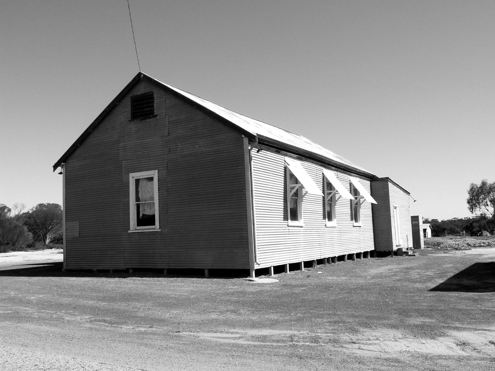 Also formed in 1912 were the Kununoppin and Trayning Progress Associations. The Trayning Association built a hall in 1913 which became redundant in 1928 with the construction of the Trayning Town Hall. The old hall was demolished in 1938 and the materials used for part of a shed on the Barnes farm. Lot 37 Coronation Street was the site of this building.
Halls were built in Kununoppin, Yelbeni and Kodji Kodjin in 1923 by local volunteer efforts. A previous smaller bough shed style building had served for dances at Kununoppin. It stood to the west of the Bank of N.S.W.
Of interest also was a request from the Trayning Progress Association in 1913 to the Road Board “to plant trees in the streets”. The result could have been the numerous pepper trees that used to line the streets; and this at a time when clearing was first getting under way!
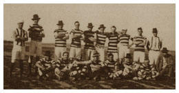 The first organised game of football was played at South Trayning on Herbert Flowers farm, later owned by Harry Riley. I believe it was against a Nungarin team. This was in 1912. Football, cricket and soccer were all popular in the early years. Tennis became increasingly popular in the 1920s and gold in the late 1920s. Women’s hockey was played in the early 1930s. Rifle shooting commenced at Kununoppin in 1915, a club had been formed at South Trayning a couple of years earlier. The Trayning Club folded in about 1920 but the Kununoppin one was active until the 1970s. Football ceased in 1990. The three teams that had existed gradually reduced to just one and finally there were not enough players available to form a team. The loss of population has many effects in a community.
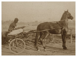 The first organised “trotting” race was in 1916. Horses in sulkies raced between Kununoppin and Trayning with the prize a barrel of beer! An unregistered club was formed in Trayning in 1917 with a track on the town common, now occupied by the golf course and catchment area. In 1923 the club became the third to be registered in W.A. after Gloucester Park and Kalgoorlie. Trotting remained very popular until funding cuts and falling T.A.B. turnover meant that insufficient funds were available to keep many country clubs going.
The first years of settlement were very difficult for farmers, drought, poor crops and prices and lack of finance meant everyone found it hard going. Things were no better in the city either. With the outbreak of war in 1914 a very large number of the less than 30 age group of men joined the army and a lot never returned.
For those left behind the seasons improved from 1915 on with excellent rains although it meant that the roads became quagmires. Land clearing went on; bigger areas of crop were sown. Rabbits were becoming an increasing problem and rabbit fencing started in earnest. There were few sheep in these early times as dingoes were common and sheep had to be shepherded and locked up at night.
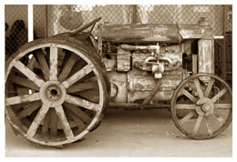 With the end of the war prices for wheat improved and by 1920 there was enough money becoming available to improve homes, fences and machines, etc. Small tractors became available in the early 1920s and for those with water shortages these were a godsend. Carting water was an endless heart breaking job. Some farmers also didn’t like horses. Life was much easier in the 1920s but rabbits in plague proportions caused havoc with crops.
The introduction of scheme water from Waddouring in 1928 was great for the towns and those farmers connected to it. In the following years increasing numbers of farms became stocked with sheep as dingoes were trapped and poisoned. The last dingo was trapped in 1935 although a couple strayed back into the area in the 1960s.
The district’s population reached its peak in 1927, 2,250 people lived here then.
The financial crash of 1929/30 saw wheat prices fall to 1/6 a bushel. Farmers who had borrowed heavily found themselves in the same position as many farmers today. Land values fell from around $10 per acre to $4 per acre, or less and their equity was. Many walked off the farms with virtually nothing. Unemployment reached 30% but banks continued to advance enough money to remaining farmers to enable them to exist and plant a crop. Horses again took over from tractors, cars and trucks, their fuel could be grown on the farm. Many families suffered real hunger both in the country and city. Boiled wheat and molasses as a meal was a reality for some. Mend and make do was the order of the times.
Local storekeepers gave credit to large numbers of people for without their help some people could have starved. It took some people years to pay off these debts, but most of them were repaid. Many small businesses failed in these years.
 By the mid 1930s things improved a little, seasons were fairly dry and grasshoppers bred up on the abandoned farms in the Mukinbudin-Bonnie Rock areas causing many problems. Sheep added to farm income and slowly cars and trucks returned to the roads in numbers and new improved rubber tyred tractors were replacing the earlier steel wheeled models. Horses were gradually phased out and I believe that Arnold Brown’s was probably the last team to work in the district in 1948.
The Road Board during the intervening years had employed contractors and farmers to gravel and grade roads. Tracks were widened into roads; some of this work had been done by “sustenance gangs”, men given just enough work to enable them and their families to survive the depression.
Much of the road works during the 1920s and ‘30s was carried out by Mr Archie Bunney, and his sons Ray and Bob along with Bill Lamond. Gravel was dug by pick and shovel and carted on a couple of ancient “Vulcan” tip trucks. A large part of the work done until the end of World War 2 consisted of filling pot holes and making roads passable. Gravel and dirt roads were corrugated to a degree many of our younger residents would not believe. Tracks along the railway line between Kununoppin and Trayning were used in preference to the road on many occasions.
Finance was always a battle for the Roads Board. Over many years arrears in rates exceeded rate income! In one of the earliest years the secretary had to go on reduced wages for a time as there wasn’t enough money to pay him.
The advent of war in 1939 again saw many men and women leave the district to join the services. Shortages of many things occurred, especially after the Japanese entered the war.
 Rationing of petrol and shortages of kerosene for tractors (diesel engines were uncommon then) led to many farmers fitting gas producers to vehicles and tractors to keep them running. This removed a lot of wood from the countryside as it was burned to produce charcoal. It was hot, dirty work.
Tea, sugar, butter, meat and clothing were all rationed; people had strong incentives to produce their own food. No one needed to go hungry but sacrifices had to be made to bake cakes.
Superphosphate supplies were very limited and the quality reduced. Areas cropped were reduced and land cleared in the 30’s went back to bush again, especially the poorer wodgil soils.
1942 saw the Allied Works Council take over part of Mr D.A. Couper’s property at Kununoppin to build the airstrip. The threat of Japanese invasion was very real at this time. Many local people were employed to help construct the airstrip, farm tractors and scoops and single furrow ploughs were used to win gravel from the cemetery hill. The completion of the airstrip occurred about the time that the first success against the Japanese took place. The threat of invasion faded and apart from training exercises the strip was never used. After the war the land was handed back to the owner.
Crop spraying planes and an occasional private plane used the strip. It was not until the late 1970s that the Flying Doctor started using the strip. The ownership of the land had passed to Mr B. Watson and the Gent family. Mr Watson allowed the Lions Club to fence the strip and the Gents made extra land available to extend the strip. In 1991/92 Council purchased additional land from the Watsons and Gents and with financial help from Nungarin, Mukinbudin and Mt Marshall Shires installed full runway lighting. The airstrip is now to full D.C.A. standards.
As the war went on, tyres became almost impossible to obtain. Old tyres were patched, recapped, sleeved – anything to keep them going. The social life of the area was enhanced with the establishment of the 5th Base Ordinance Depot at Nungarin. Some 1,200 men and women occupied this camp at one time. The workshops repaired tanks and vehicles. The troops patronised the dances and any sporting occasions. They also added to the sporting scene with a football team for a time.
 In the post war period, land that had been abandoned during the thirties was taken up by returning servicemen, new and bigger tractors became available and there was for the next decade an orgy of land clearing. Today we are replanting trees and trying to stem the encroachment of salinity that has resulted from these clearing excesses.
After World War 2 changes to the way roads were constructed and maintained were introduced. The Road Board bought its first tip truck and grader in 1947-48 and since that time has always had a works gang. Today’s good roads are a tribute to all the workers who have laboured effectively over the intervening years. Good plant, good workers and good organisation and supervision have made possible the amenities and infrastructure that we have today.
The health of the district and that of the adjoining Shires has since 1925 been in the care of the Kununoppin Hospital and the doctors who have been associated with it. Before that time Merredin, Kellerberrin or Dowerin were the nearest sources of medical help. Mrs D. A. Couper was one of those who acted as midwife to many early mothers and any women with nursing experience were highly valued. Self medication often a packet of epsom salts was a common cure-all. Despite the crudity of some medication, people survived infections of many sorts. Poor diet and suspect water led to many problems. Barcoo rot, sores that didn’t heal, boils and a number of other problems have largely disappeared as frozen and fresh vegetables are available year round. We owe a debt of gratitude to all the many doctors and nurses together with the Hospital Board Members who have given loyal and unstinting service to our communities.
The prosperity resulting from the wool prices of 1951-52 saw enormous strides made in the mechanisation of farms. New homes replaced ageing early constructions. The wet years of the early 60’s saw farms expand production and introduce new pastures. Sheep numbers rose. The drought of 1969 followed by mostly drier and some drought years has seen farmers again suffering some of the same effects as were experienced in the 1930s. Farming in recent years has suffered low prices, high interest rates, high input costs and several droughts. They have always had to cope with some of these things, but in recent times, these blights have occurred simultaneously. The effects on population have been devastating; there are less than 500 people in the Shire today.
DON COUPER (dec)
September 1992

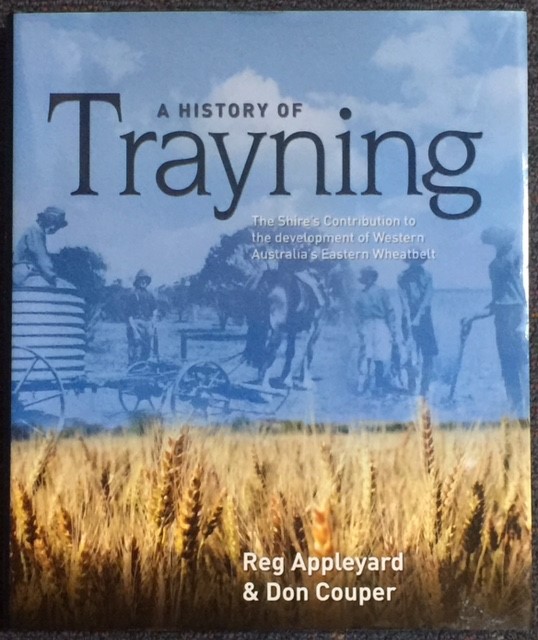
A History of Trayning by Reg Appleyard and Don Couper
These books make great gifts!
Copies of the hard cover book may be obtained at the Shire of Trayning Administration Office.
To obtain your copy please contact the Shire Staff.